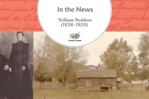
Many family historians aim to travel to the home country of an ancestor and stand on the land they once inhabited. Another way to connect to our ancestors is to visit places they also visited. If lucky, we can find ship manifests detailing an emigrant’s journey across the ocean, but how did they reach their final destination? That may take good sleuthing in a variety of records.
I recently visited upstate New York, where my 3rd great grandparents, William and Mariah (Brockhouse) Beddoes, traveled through in 1868 on their way to Utah Territory. Relying on histories and published sources, I’ve pieced together a possible route and visited some places they also likely toured.
Niagara Falls

William and Mariah Beddoes
William Beddoes and Mariah (Brockhouse) Beddoes emigrated to the United States in 1868, and a history written by their grandson, Frank Beddoes, mentions that “on their way west they had a chance to see Niagara Falls.”1 William and Mariah traveled in steerage on the steamship S.S. Colorado, departing from Liverpool and arriving in the port of New York on 8 July 1868. Their final destination was Utah Territory, and they needed to get to Benton, Wyoming, the outfitting post for the wagon trains westward. The Daniel Duncan McArthur Compay departed on 14 August 1868, so William and Mariah had five weeks between their arrival in New York and departure for Utah Territory from Wyoming.
Where did they go, and what did they see on their way west? William’s history gave me a clue that they had been to Niagara Falls, and learning about the region’s history gave me some ideas about their mode of travel and route. My own visit to Niagara Falls left me wondering about the impact it would have had on my ancestors in 1868. I learned more about the timeline of the area.2 The first explorers to the region heard of the falls from the native people inhabiting the shores of the St. Lawrence River. The first documented viewing by a European was on 9 December 1678 by Catholic Priest Father Louis Hennepin and explorer Rene-Robert Cavelier de La Salle. Hennepin sketched an image and included it in his book Nouvelle Decouverte (New Discovery), published in 1697 in France, then translated and published in English in 1699.
Europeans were fascinated with the account of the immensity and power of the falls, and travel to the region began. George-Louis le Rouge’s 1755 sketch of the falls captures the power of this natural wonder.3

1755 Sketch of Niagara Falls by George-Louis Le Rouge
With the French and Indian War between 1754 and 1763, the Niagara region saw many battles between two groups: the British, American Colonials, and Iroquois Nation and the coalition of French and their Native allies. When the war ended in 1763, Britain had won most of Canada, including the Niagara area. Following the Revolution, Fort Niagara remained in the hands of the British until the Jay Treaty secured the fort and surrounding land to the United States.
The Niagara Falls honeymoon tradition began in 1801 with Theodosia Burr (President Aaron Burr’s daughter) and Joseph Alson’s honeymoon to the falls. When war broke out in 1812 between the British and Americans, the area once again saw war, and Buffalo was destroyed by fire. With peace finally established, the development of the western half of New York progressed rapidly – beginning with the Erie Canal project that connected the Hudson River of eastern New York state to Lake Erie on the western border.
By the time William and Mariah visited Niagara Falls, the Niagara Railway Suspension Bridge had been completed. Built by John August Roebling, this was the first rail bridge to cross the gorge. They likely traveled by train west to Buffalo and then north to the falls. Once there, they could have descended the gorge via the Biddle Staircase and entered the Cave of the Winds. They might have taken a ferry ride on the Maid of the Mist to see the falls up close. Perhaps they viewed the falls from the Canadian side as well as the U.S. side. Their experience was significant enough for William to discuss it many years later with his descendants.
Erie Canal
Construction of the Erie Canal began on 4 July 1817 in Rome, New York, and was completed on 4 November 1825. Eventually, spanning 360 miles from Albany to Buffalo, New York, there were many obstacles to overcome in the construction: heavy forests, the incline to the Niagara Escarpment, and many rivers and streams to be bridged with aqueducts.
After the Revolution, the British transferred 233 million acres of land called the Northwest Territory to the United States. The new country needed an easier way to move people and goods west than on roads to settle this area. Water travel was much more efficient. To illustrate, a horse could move two tons of people or goods on a smooth road. A horse could move fifty tons of people or goods on a canal.
Because the Niagara Escarpment was significant, locks needed to be built in strategic places to raise or lower watercraft to the next level. Eventually, 83 locks were required to level the canal and ensure safe passage. The canal was an engineering marvel – the longest canal built in the least time, with the least experience, for the least money, and for the greatest public benefit. The canal provided many jobs for immigrants and gave an easy path west for immigrants to the Midwest. The canal opened the way for tourism, but more importantly, for migration west and the shipping of goods between the eastern U.S. and the west.
The canal provided easterners with a scenic 10-day trip to Buffalo, New York, where they could head north to view the falls. Guidebooks for travelers described multiple ways to travel using the Erie Canal and other canals throughout western New York and into Ohio. For example, J. M. Peck’s New Guide for Emigrants to the West gives important details about traveling through this region.4
The Ohio and Erie Canal connects lake Erie with the Ohio River. It commences at Cleaveland, at the mouth of the Cuyahoga, passes along that river and it tributaries to the summit level, from thence to the waters of the Muskingum, and to the border of Muskingum county . . .
Unfortunately, passenger lists were only kept in the early years of the Erie Canal. Still, the New York State Archives has many collections related to the Erie Canal, including contractors who worked on the canal between 1817 and 1871 and sectional canal survey maps that show property owners along the canal. The Erie Canal Museum in Syracuse, New York, has photographs and documents relating to the canal and its workers, available digitally on New York Heritage digital collections.
Railroads
Travel by rail was much faster than on the canal, so when people could travel west by train rather than barge, they soon switched. However, the canal continued to move freight between the east and west. When my ancestors, Mariah and William Beddoes, immigrated in 1868, they likely took the train. I don’t have an account of this part of the journey, but imagine they took the route paralleling the Erie Canal and viewed this man-made wonder many times in their journey across New York. Once William and Mariah arrived in Buffalo, they likely took the train north to Niagara Falls and may have explored the falls for a day or two before continuing their journey west.
Newspapers printed the latest railroad schedules, such as this notice in the Buffalo Courier Express of 4 November 1868. Under the heading “Traveler’s Guide,” many railroad timetables are detailed, including the Erie Railway, the Great Western Railroad, the N.Y. Central Railroad, and the Erie & Niagara Railroad. Below each listing is the timetable for destinations from Buffalo to Niagara Falls and Lockport.5
Traveling the same route as William and Mariah and viewing Niagara Falls was a fun way to connect to these ancestors! Perhaps they also took a ferry ride up to the falls and wondered at the sheer power of this natural wonder.
Best of luck in all your genealogical endeavors!
Sources
- “A History of William Beddoes as given by Frank Beddoes,” (1838-1920) KWCB-KQ4, FamilySearch (https://www.familysearch.org/photos/artifacts/99626493 : accessed 4 November 2023), contributed by Jodee Lee Parkin, 12 January 2020.
- “Niagara Falls Historical Timeline,” NYFAlls (https://nyfalls.com/niagara-falls/history/ : accessed 24 November 2023).
- Georges-Louis Le Rouge, “Sault du Niagara, de 135 pied de haur, (Paris, 1755); Library of Congress (https://www.loc.gov/resource/g3312n.ct001260/?r=-0.208,-0.083,1.59,0.969,0 : accessed 25 November 2023).
- J.M. Peck, A.M., New Guide for Emigrants to the West, Containing Sketches of Ohio, Indiana, Illinois, Missouri, Michigan, with the Territories of Wisconsin and Arkansas, and the Adjacent Parts (Boston: Gould, Kendall & Lincoln, 1836), 208; Internet Archive (https://archive.org/details/newguideforemigr00pec/page/n3/mode/2up?view=theater&q=erie+canal : accessed 26 November 2023).
- “N.Y. Central Railroad Timetable,” Buffalo Courier Express, 4 November 1868, page 2, column 7, digital image, Newspapers (https://www.newspapers.com/image/343785644/ : accessed 26 November 2023).


Leave a Reply
Thanks for the note!