
The celebration of the U.S. Semiquincentennial provides an opportunity to reflect on our colonial ancestors who lived during the Revolution. We may not have traced many of our ancestors to this era, but for those we have, we can use historical context to tell their story. In this series, I’ll share my experiences in researching my colonial ancestors – men and women – and invite you to consider ways you can discover and honor your own America 250 Ancestors.
My husband and I recently visited Washington, D.C. for the first time and saw reminders of George Washington throughout the city, such as the Capitol, the Washington Monument, and the National Gallery.
-
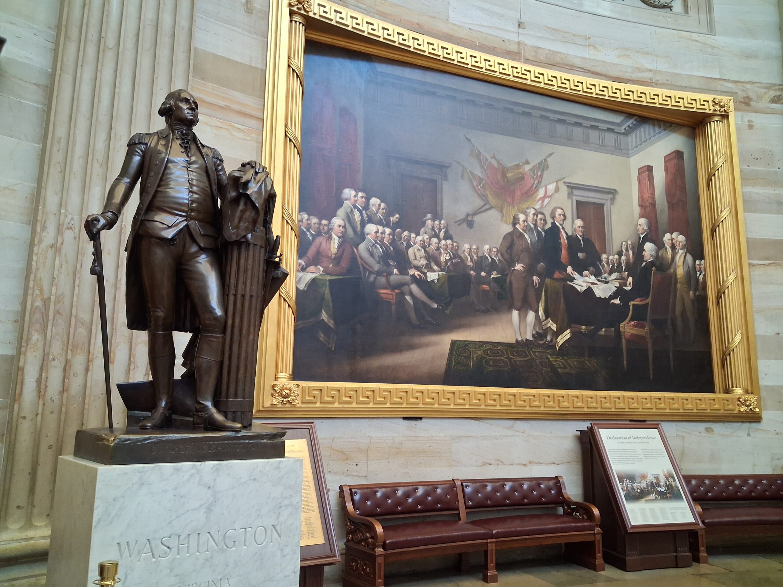
- Statue of Washington in the Capitol
-
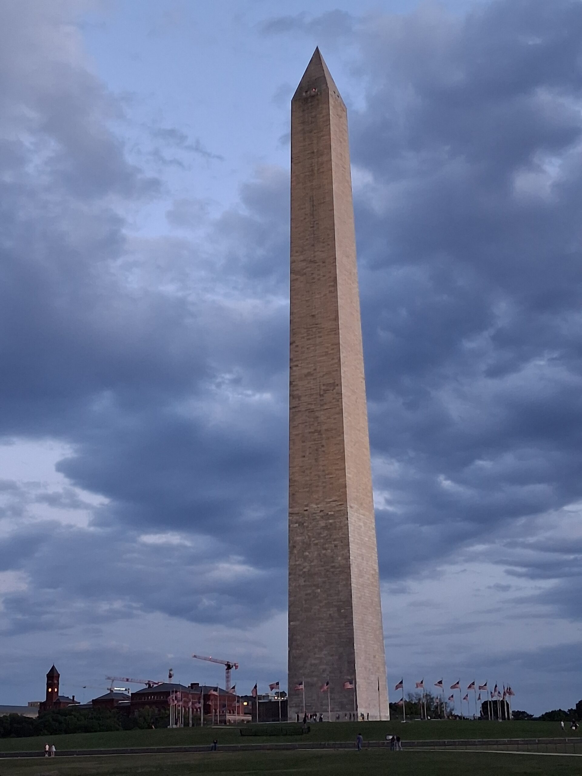
- Washington Monument
-
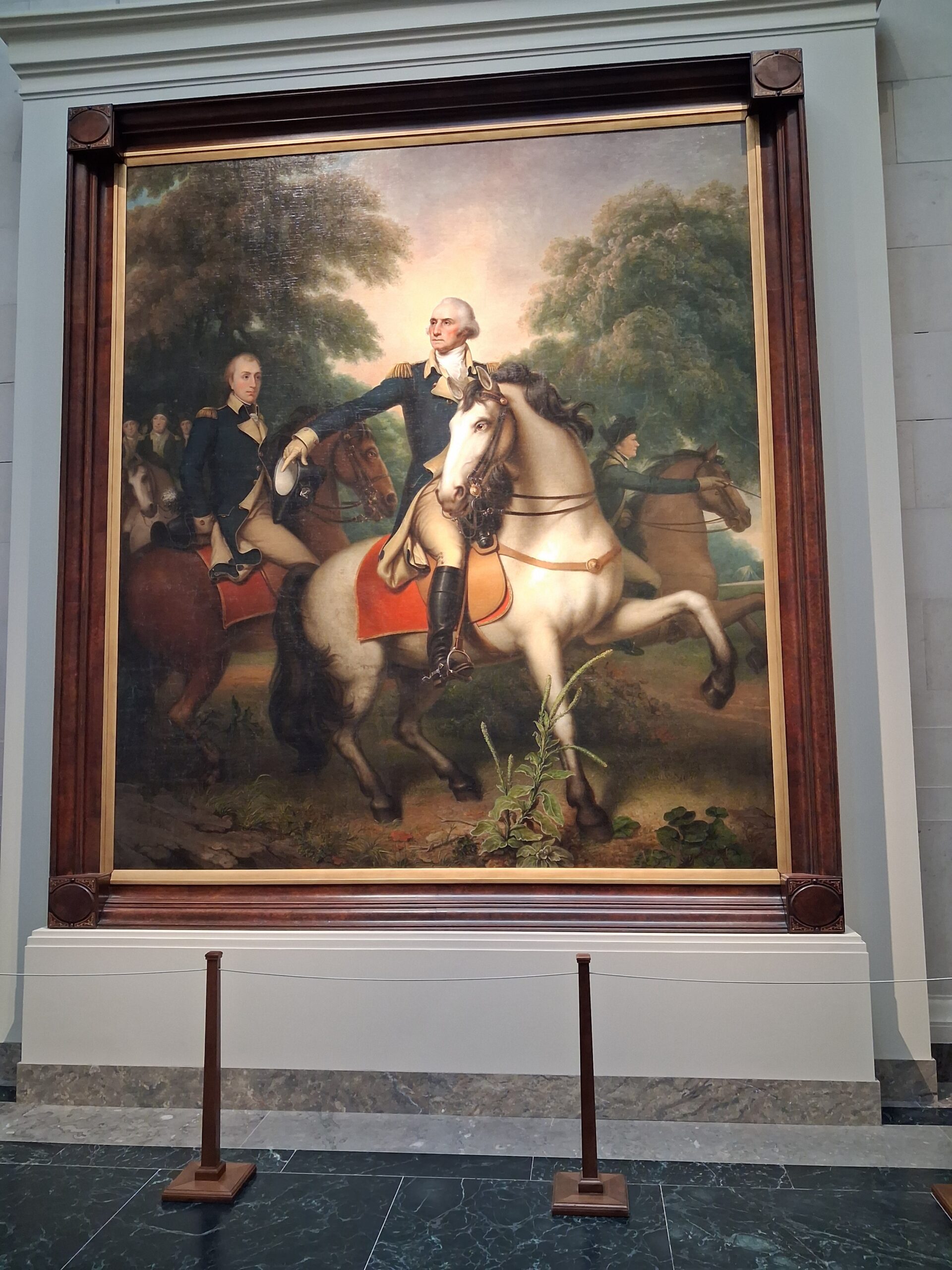
- Painting in the National Gallery
Mount Vernon
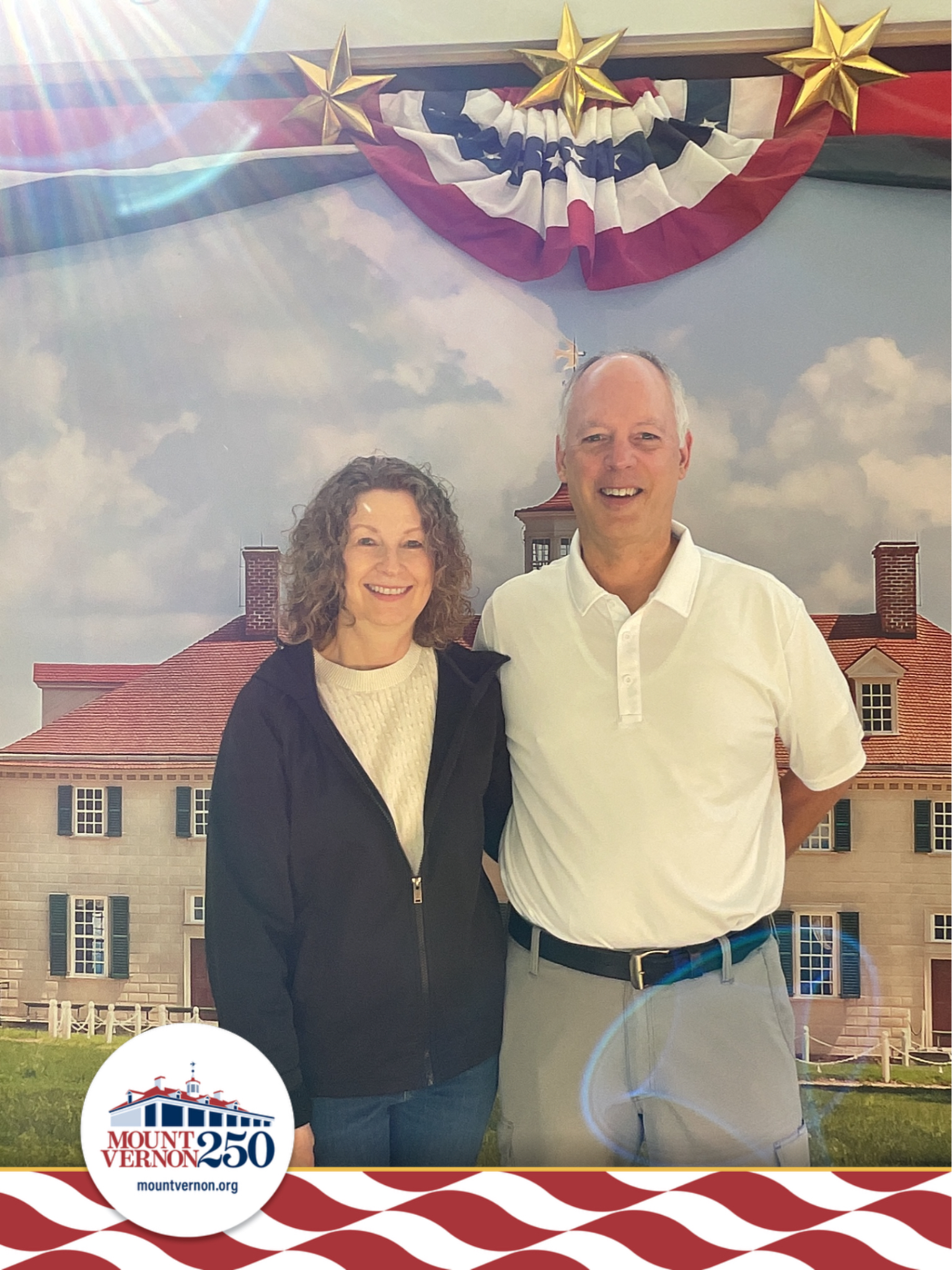
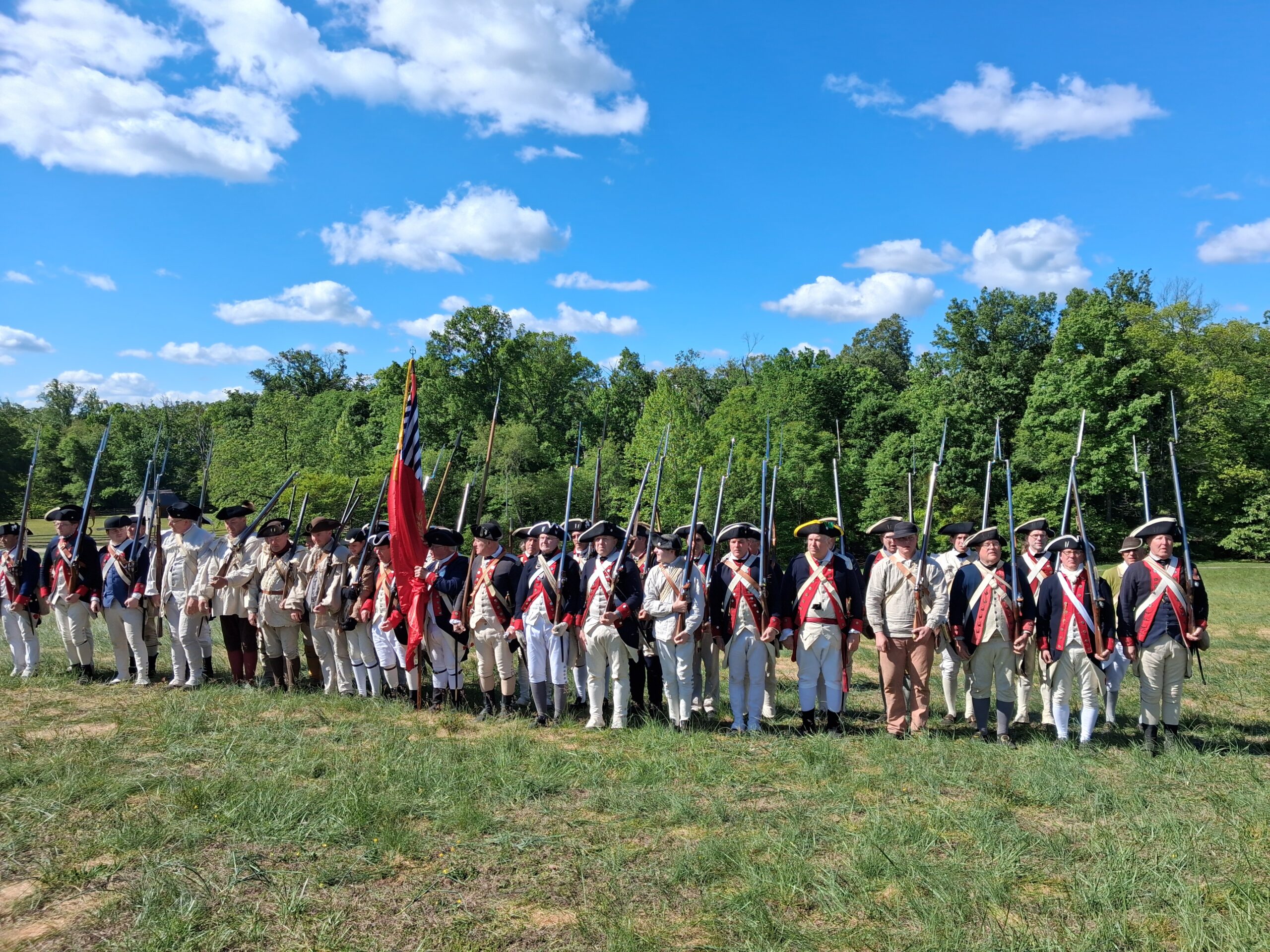
High on our list was a visit to George Washington’s Mount Vernon. Little did we know that our visit coincided with Revolutionary War Weekend, during which hundreds of volunteers had set up a military encampment and conducted drills throughout the day. We toured the mansion, visited the vendor tents, and saw George Washington’s tomb.
-
- Mount Vernon Visitors Center
-
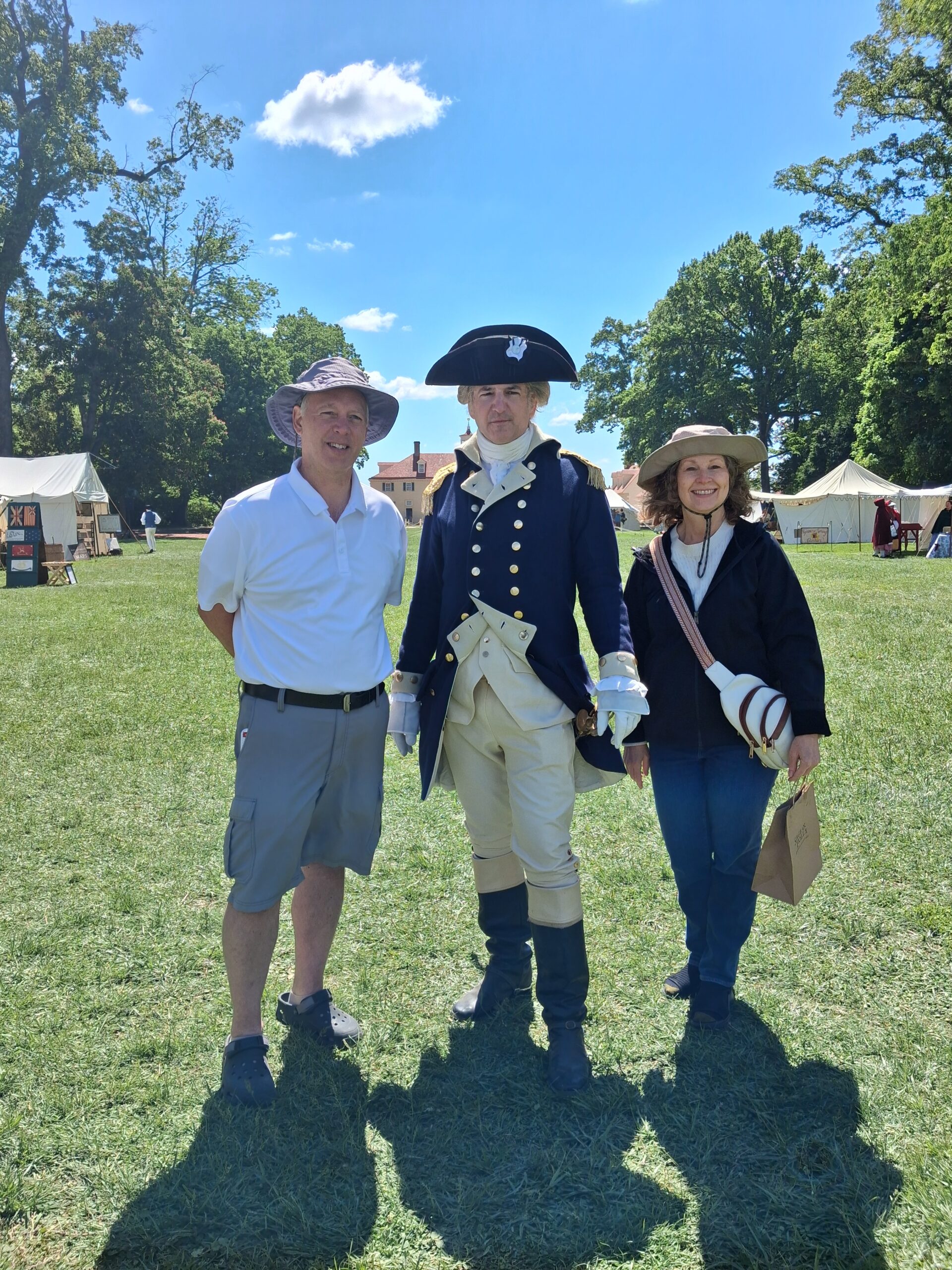
- General George Washington at Mount Vernon
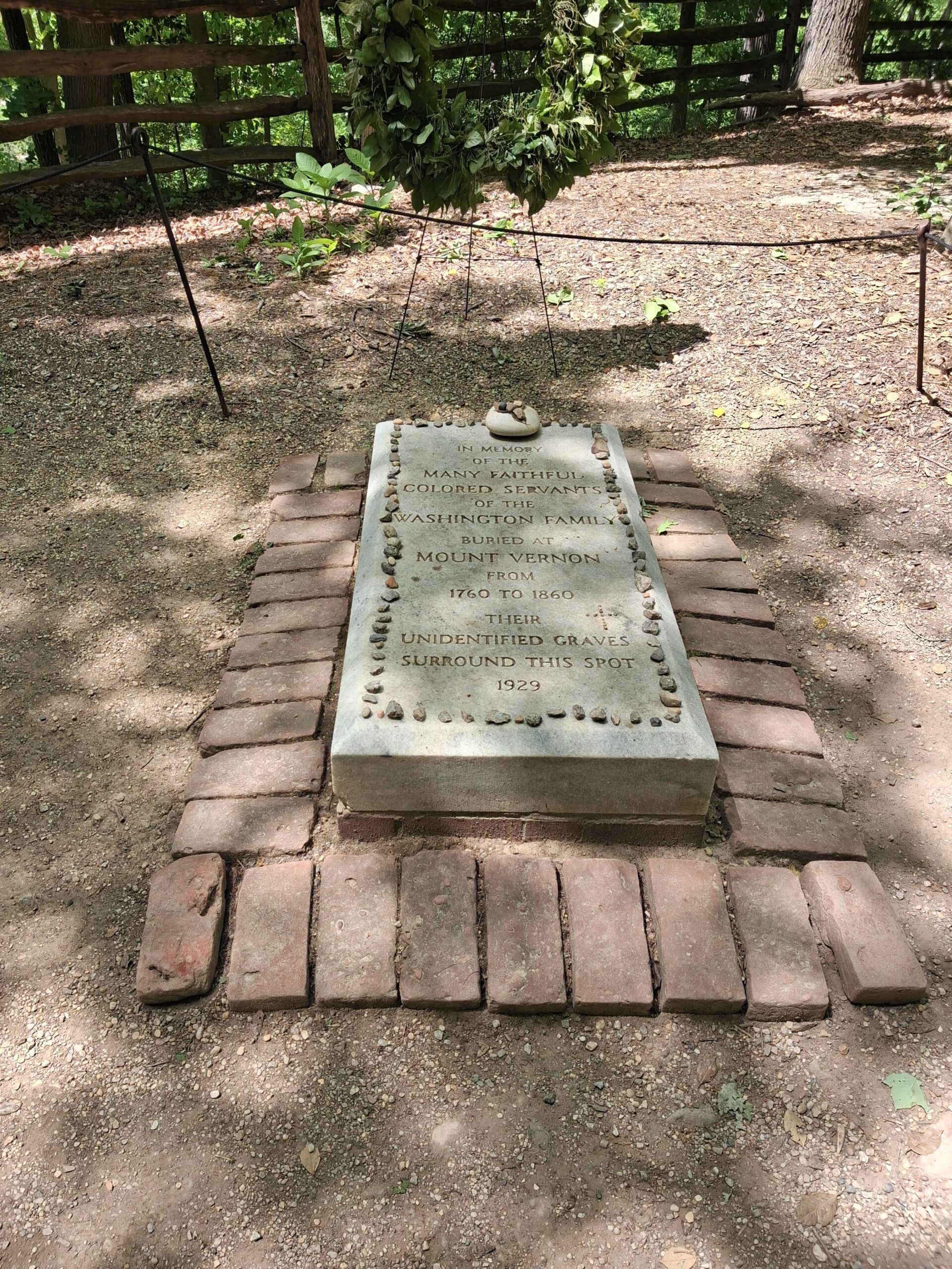
We also visited the slave quarters and the Slave Memorial, where remains have been found of some of the 317 enslaved people who toiled on the estate. In 1929 the Mount Vernon Ladies Association placed a memorial stone that reads:
In memory of the many faithful colored servants of the Washington family buried at Mount Vernon from 1760 to 1860. Their unidentified graves surround this spot.
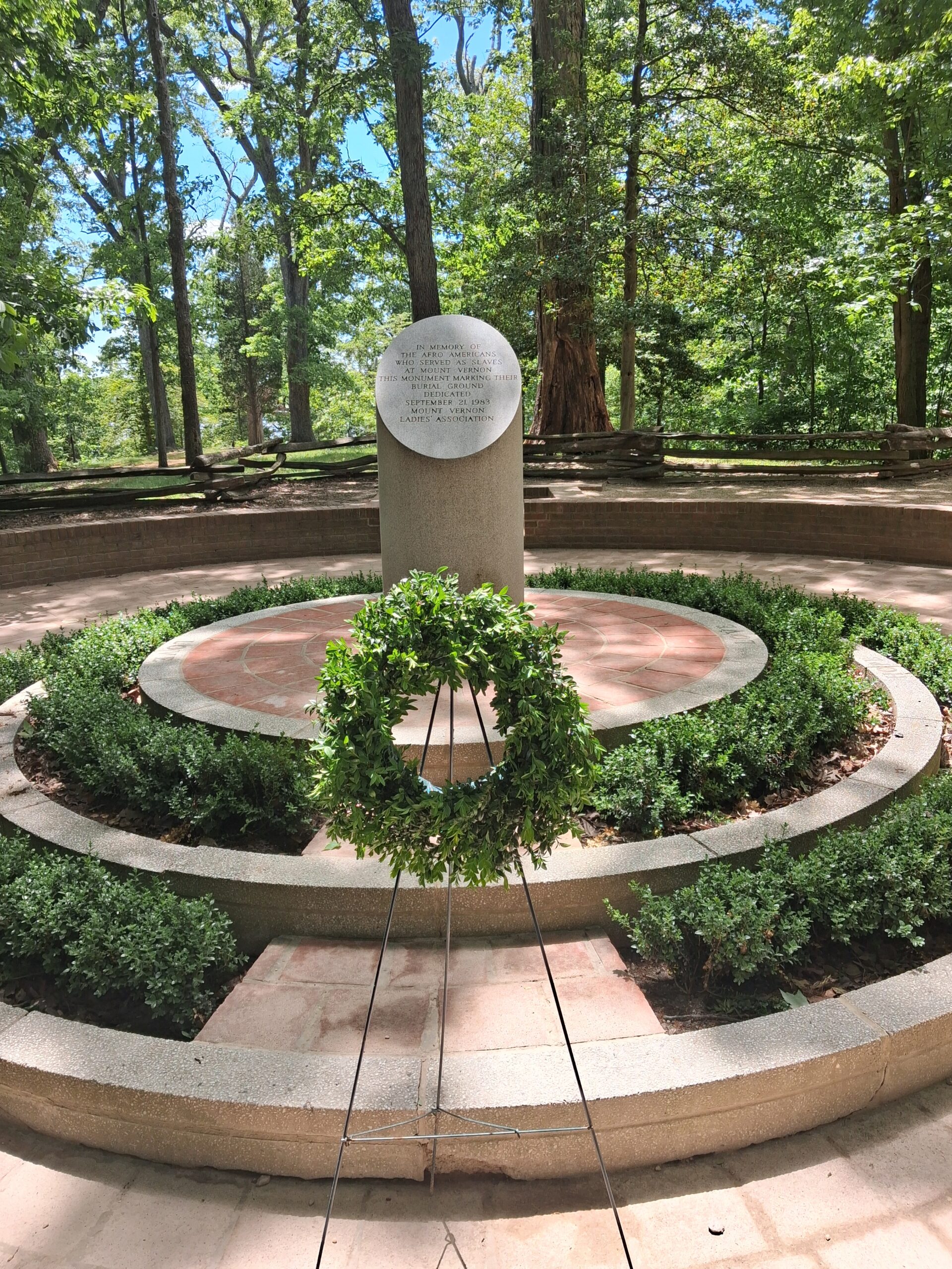
A new slave memorial was designed by students at Howard University and dedicated in 1983. As you enter this solemn space, you’ll see graves marked with stones where archaeologists have identified as burial sites for the free and enslaved African Americans.
The article 10 Facts About Washington & Slavery sheds light on this subject. Although 317 individuals were enslaved at Mount Vernon when Washington died in 1799, by law his will only freed the 123 individuals that he owned. The other 153 were owned by the Custis estate from Martha’s first husband and could not be freed by Martha. Those people were divided among Martha’s grandchildren.
-
- 1929 Slave Memorial
-
- 1983 Slave Memorial
-
- African American Burial Ground
Richard Wiatt Royston and George Washington
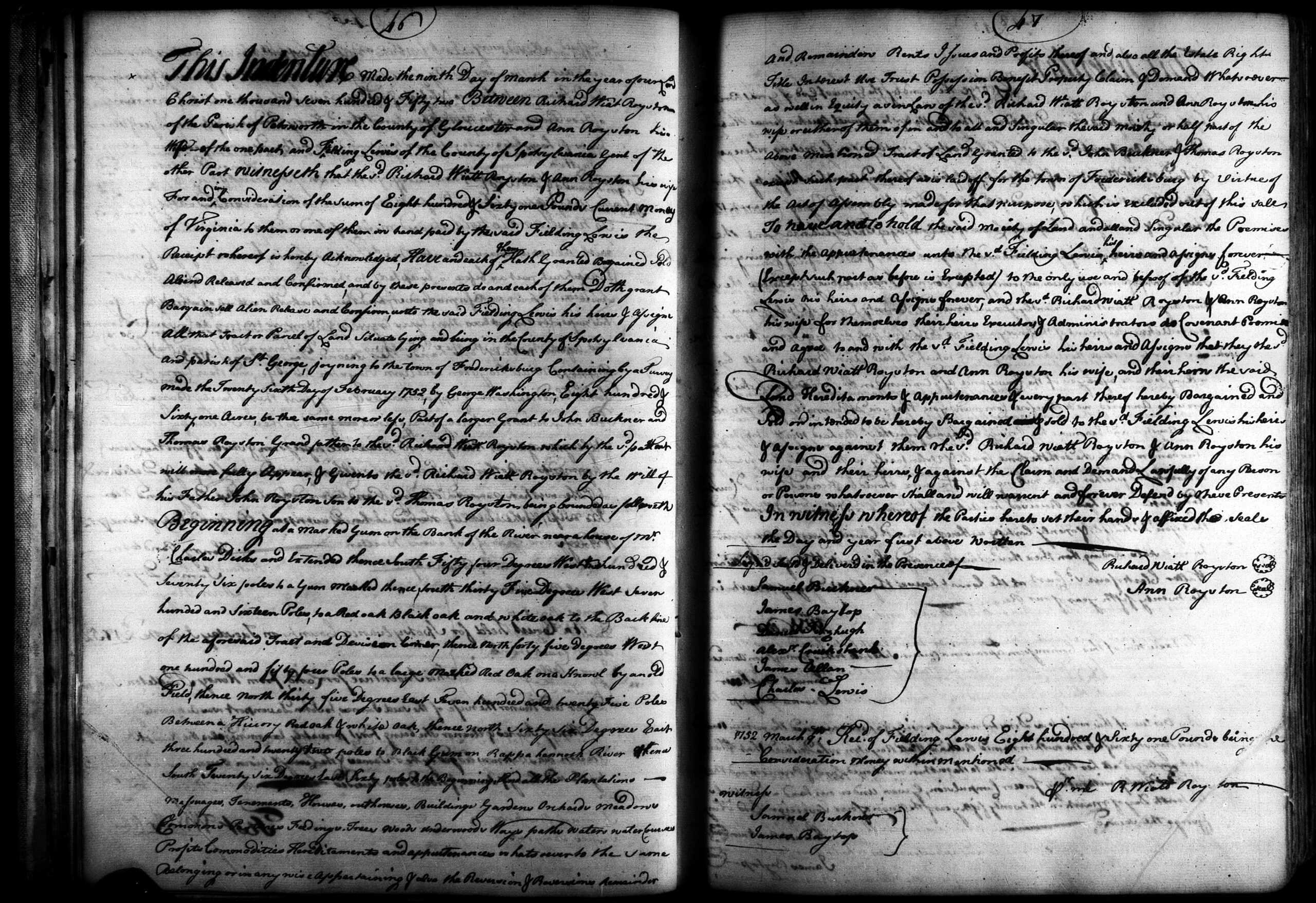
I have a slight connection to George Washington through my 5th great-grandfather, Richard Wiatt Royston. Richard and Ann, his wife, sold land to Fielding Lewis that George Washington surveyed in 1752.1 Fielding Lewis was the brother-in-law and second cousin of George Washington. Fielding was born on 7 July 1725 in Gloucester County, also the birthplace of Richard Wiatt Royston. Born about 1720, Royston and Lewis were close to the same age and part of the same Virginia planter class.
George Washington began surveying land at the young age of 15 and from 1749 to 1752 worked professionally as a surveyor. The Royston land he surveyed was on the Rappahannock River adjoining Fredericksburg. The land was part of a larger grant originally made to John Buckner and Thomas Royston (the grandfather of the grantor, Richard Wiatt Royston). The property passed from Thomas Royston to his son John Royston, who then bequeathed it to his son, Richard Wiatt Royston, via his will.
Richard Wiatt Royston resided in Petsworth Parish, Gloucester County, Virginia. Unfortunately, Gloucester County suffered catastrophic record loss, and no deeds or wills remain for this era. But because the deed was recorded in Spotsylvania County, we have evidence of three generations of Roystons.
The transcription reads:
Part of a larger Grant to John Buckner and
Thomas Royston, Grand father to the sd Richard Wiatt Royston which by the sd patton
will more fully Appear, & Given to the sd Richard Wiatt Royston by the Will of
his Father John Royston Son to the sd Thomas Royston
Google AI Studio did a remarkable job transcribing the deed and provided the following abstract.
Abstract of Deed
- Date of Instrument: March 9, 1752
- Grantors: Richard Wiatt Royston of the Parish of Petsworth, Gloucester County, Virginia, and Ann Royston, his wife.
- Grantee: Fielding Lewis of Spotsylvania County, Virginia, Gent.
- Consideration: £861 (Eight hundred and sixty-one pounds) current money of Virginia.
Property Description:
- Location: Parish of St. George, Spotsylvania County, Virginia, “joining to the town of Fredericksburg” on the bank of the Rappahannock River.
- Acreage: 861 acres (more or less).
- Survey Details: Specifically noted as being “by a Survey made the Twenty Sixth day of February 1752 by George Washington.”
- Boundaries: Begins at a marked Gum on the bank of the river near the house of Mr. Charles Dick; includes references to the “Back line” of the original tract and various marked trees (Red Oak, Black Oak, Hickory).
- Exclusions: Any land previously laid off for the town of Fredericksburg by Act of Assembly is excluded from this sale.
Summary of Richard Wiatt Royston and his Wife, Ann
Before I learned to write source-cited reports, I created summaries of my research from 2003 to 2008. The following is one of those summaries. A future project will be to revisit this research and find original records and additional sources now available online. I previously wrote blog posts about Richard’s son John Royston, the runaway apprentice and the court case that ensued but hadn’t yet focused on Richard. Here is my summary:
Richard Wyatt Royston, son of John Royston and grandson of Thomas Royston, is first mentioned in the 1751 land sale of lots 27 & 28 in the town of Fredericksburg. His father had been ordered to build Warehouses on these lots in 1742, but was an absentee landlord, and the warehouses were in need of repair by 1748. The warehouses continued to carry the Royston name until they burned in the fire of 1807.
In 1752, Richard Wiatt and his wife, Ann, are recorded selling 861 acres of land to Fielding Lewis. This land was the rest of the patent granted to Thomas Royston and John Buckner in 1671. Young George Washington ran the survey for his brother-in-law, Fielding Lewis.
Richard Wiatt is listed in the Vestry Books of Kingston and Petsworth Parish. The first entry in the Vestry Book of Petsworth Parish is dated 26 Aug. 1755 and he is mentioned many times until the last entry in 1790. The entries in the Kingston Parish Vestry book are from 1770 to 1772. According to Mary Wiatt Gray in her book, Gloucester County,
The first church in Gloucester County was built in Purton in Petsworth Parish and given the name of Petsworth. This church was built and named by Mrs. Ann Bernard and her son-in-law, Colonel John Smith, who lived in Purton at an early date. They gave the parish the name Petsworth from their old home parish in England. . . We know very little more about the church in Purton, except that an old record states that this building was beyond repair in 1694. . .
Another church of the same name was built at Poplar Spring. . This second church must also have been a frame building, because we read that in 1723 a contract was made by the church with James Skelton to build a new church in the same place costing 1,190 pound in Virginia currency. This new Petsworth Church was of brick and was completed and in use before 1735, for an old record tells us that in that year an immense organ was bought in England for Petsworth Church and shipped to Virginia and landed at Poropotank.
An artist, Richard Cooke, of King George County , was employed and he painted the altar pieces and frescoed the walls with clouds and angels. There was a mural painting of the “Last Judgment” over the chancel. All this painting was expensive, for again we read from an old account that at a vestry meeting in 1735, it was noted they were directed that seven hundred gold leaf be ordered for the use of the painters.’ (gold leaf was for gilding and was very costly.) This church was a very fine church for a newly settled land. It was so handsome and so grandly fixed up that accounts of its splendor have come down to us by word of mouth from generation to generation.
Petsworth lasted for many years. Its congregations were rich and prosperous from their fine tobacco crops. All this wealth and prosperity continued until after the Revolutionary War. At that time other denominations came into being and the congregations at the Episcopal churches, as well as the money being paid into them, now went largely to the new churches. The whole nation, too, was poorer after the six years of war, and the population seems to have grown smaller in Petsworth District about that time.”
Richard Wyatt’s, son, John Royston, was a runaway apprentice in 1770. Samuel Daniel of Middlesex County advertises his disappearance in the Virginia Gazette,9 February 1770.
Run away from the subscriber, an apprentice lad named John Royston, son of Mr. Richard Wiatt Royston, of Gloucester county, 19 years old last September, about 5 feet 6 inches high, has a frowning down look, and light brown hair tied behind, though not very long; had on a light coloured frieze coat, with a small cape to it, and bound with ferreting, a new broadcloth waistcoat and breeches, I think blue or blue gray, of pretty fine cloth, and took with him sundry other clothes. He rode away a small iron gray mare, and old saddle, which has been one of the best kind, though much worn. He may pretend to know something of the chair making and blacksmiths business. I hereby forewarn all person from employing or harbouring him, on their peril. Whoever takes him up, and brings him tome, shall have 30s. reward.
Samuel Daniel. N. B. I have great reason to believe he is in Bedford county, or Prince William, among his acquaintances. Middlesex, Feb. 9, 1770
Several court proceedings are on record in Middlesex County from 1772 to 1774 between Richard W. Royston and Samuel Daniel.
Richard Wyatt is listed in 1779 and 1783 on Gloucester County tax lists and is on the Hubbard list of 1783 for heads of families, in Petsworth Parish. In his household are seven white and eight black people. The 1784 Hubbard list shows nine white people, one dwelling and three other buildings.
In 1778 and 1780 he signed petitions by John Fox regarding approval for a ferry. In 1786 he signed a petition asking that the act for incorporating the Protestant Episcopal church not be repealed.
According to a 1788 petition of Mrs. Fox, Richard W. Royston, along with William Duvall, and James Jones, was unable to account for his taxes in the years 1782 and 1783. Mr. Fox became responsible and upon his death, the estate of his widow and orphans was about to be sacrificed.
Sir John Peyton therefore intercedes for Mrs. Fox and begs that judgement suspended over her estate and over himself may not be executed and threatened, whereby their ruin and abject poverty must follow. He shows why it has been impossible to collect the public dues. The poverty of the people is extreme. They have found it necessary to agree among themselves not to purchase the effects of each other when seized by the officers of the law, hence no sale can be made to satisfy execution; and even if this could be done, the prices of property are so low that utter ruin must overtake those forced into the market.
To add to this state of affairs on the 23rd and 24th of the month of July a dreadful storm and highest tide even known occurred, which has laid waste all over the lower county, destroying the crops and sweeping away livestock of every kind. Scarce is a plantation which has not suffered by the blowing down of houses. The distress of the people is beyond all conception. Hundreds of families in this county are deprived of everything for another year’s subsistence. The tide, which was six feet deep in some of their houses, has swept all before it and drowned several of the inhabitants. Corn, flax, cotton, and vegetables of every kind died wherever the tide went, if it was not swept away, so that the people are deprived of every necessity of life, even their stock of old corn, horses, and cattle and the greater part of the sheep, hogs, and fowls. A person, one of the sufferers is now present.
His accounting of the damage exceeds anything I ever heard of in this part of the world. I am one among them in a small degree to hundreds of others. If something is not done for the relief God knows what will be the consequence. I fear their distress will not here end, for those Lands which have been overflowed are so impregnated with salt that I doubt whether thy will produce anything for some years to come. The loss of fencing alone, had there been no other damage, would have laid the people under great difficulties; indeed, in many places it is almost irreparable. The losses cannot be enumerated. The sight of the plantations are shocking spectacles and the stench of the corn, grass and other vegetables is most disagreeable. (Calendar of Virginia State Papers and Other Manuscripts)
Richard Wyatt’s last entry in the Vestry book of Petsworth Parish is dated 5 April 1790, leading to the belief that he died soon after.
Gloucester County and the American Revolution
Gloucester County is directly opposite Yorktown on the north side of York River and was heavily involved in the Revolutionary War. British General Cornwallis used this area as a base and constructed fortifications there. A 1781 map of the Siege of York at the Library of Congress shows a portion of Gloucester County in the top right corner. 2 General George Washington forced Cornwallis to surrender at Yorktown after a surprise attack.
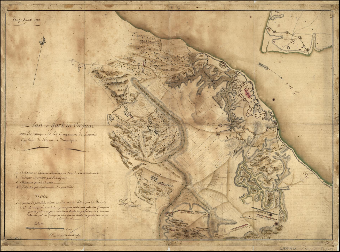
Richard Wiatt Royston born about 1720 was in his 50’s and 60’s during the war years. With an enemy army just across the river, it’s no wonder that the people were impoverished and couldn’t pay taxes in the years following the war. Archaeology is slowly revealing evidence of damage such as burned and demolished houses. 3
We can’t know for certain our ancestor’s Revolution stories but piecing together what little we do have along with historical context can provide us with a richer view of their lives and sacrifices during this era.
Best of luck in all your genealogical endeavors!
Sources
- Spotsylvania County, Virginia, Deed Book E 1751-1761, p. 46-47, Richard and Ann Royston to Fielding Lewis; imaged, FamilySearch (https://www.familysearch.org/ark:/61903/3:1:3Q9M-CSKV-58CT : accessed 17 May 2026), IGN 008153248, image 29 of 461.
- Querenet De La Combe. Siege d’York, . Plan d’York en Virginie avec les attaques et les campemens de l’Armée combinée de France et d’Amérique. [1781] Map. https://www.loc.gov/item/gm71002176/.
- “The Battle of the Hook, and Researching Gloucester’s Revolutionary War Landscape,” blog post, 21 October 2013, Fairfield Foundation ([https://fairfieldfoundation.org/the-battle-of-the-hook-and-researching-gloucesters-revolutionary-war-landscape/ : accessed 17 May 2026).


Leave a Reply
Thanks for the note!